Killer Maps
This excerpt of a longer article about Google Maps strikes me as heralding an important point in augmenting physical reality, as well as being quite apropos to our focus. The full article is Killer Maps
Annotating the Planet (page 6 of 6)
As the big three vie for Web users' loyalty, they're likely to introduce more ways for people to import their own data and see it displayed on professional-looking maps. Google Earth Plus, an enhanced subscription version of the program, allows users to upload and view data collected by their GPS units, such as "tracklogs," series of virtual bread crumbs showing where the user has been.
And other companies are getting into the mix. A program for Nextel GPS camera phones, Trimble Adventure Planner, helps users create online travelogues by uploading photographs and pinning them to the appropriate spots on a Web map.
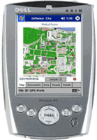
Siemens, meanwhile, is developing software that will let a GPS-enabled mobile device associate notes with specific coordinates; when someone else with a similarly programmed gadget approaches the coordinates, the note appears on his or her screen. A tourist bureau might "label" a particular spot along San Francisco's Embarcadero as the site of a fatal duel in August 1879. John Udell, a columnist for InfoWorld, has coined a phrase for this phenomenon: "annotating the planet."
It's a trend that the main providers of mapping platforms have every incentive to encourage. After all, as the history of the Web itself has shown, interesting content draws more traffic, which drives more click-throughs. "The world is really dense with information," says Schuyler Erle. "Access to ubiquitous networking and location-finding services means that we can take that information and make it accessible in the places we are actually in, when we need it, and that allows us to make much more intelligent decisions on the spot, at that time."
Every page on the Web has a location, in the form of a URL. Now every location can have a Web page--indeed, an infinite stack of them. That may sound like a recipe for information overload. But in fact, it means that navigating both the Web and the real geography around us is about to become a much richer experience, rife with occasions for on-the-spot education and commerce. It means that we will be able to browse the Web--and the virtual earth encompassed within it--simply by walking around.
Wade Roush is a TR senior editor based in San Francisco.

0 Comments:
Post a Comment
<< Home