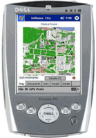
GPS+PC+Phone+Camera
As this May 2005 article points out, place-based games aren't the only option (and to be honest, the article even failed to mention games...), but does mention other PBI activities that I've mentioned on this here before -- although their focus os on the commercial aspects rather than the educational aspects:
Bones in Motion monitors and measures physical activity in fitness programs. It records time, distance, speed, location, and calories burned while engaging in outdoor activities. Users can view activity summary, maps (street/topographical/satellite), and speed/elevation charts on their GPS-enabled phones, upload results to a personal online journal, and download maps of routes where other users have run, cycled, or walked — for example, when visiting a new city.

Bones in Motion received $60,000 in cash and $175,000 worth of NAVTEQ map licenses. Other category winners, who garnered $10,000 cash and $75,000 worth of map licenses each:But where is learning? And who's addressing that? Well, I hope that the work MIT is doing with their new ARG editor will evolve and make the leap into cell phones. It is currently very difficult to program for mobile phones due to silly stuff like trade secrets -- the companies are not openly sharing that information, leaving the heavy lifting to individuals to discover it on their own (and post it to their blog).
* in personal security, Clarity Communication Systems Inc. for Whereabouts, a child/teen tracking service for parents;
* in peer-to-peer/find me, LOC-AID Technologies for helping users locate friends, children, family members, or nearby points of interest, and to share their own location with designated peers;
* in navigation/POI look-up/traffic, InfoGation Corporation for Adeona, giving real-time traffic, weather and gas-price information, and nearby points of interest;
* in commerce/advertising/buying/billing, Smarter Agent, acquiring user location from the phone and delivering data such as sale prices, comps, taxes, and houses for sale and recently sold in the vicinity;
* in gaming/location-based imaging, Networks In Motion, Inc. for PhotoFinder, enabling users to manage photos containing location tags, view them on a map, and send to another phone or website with navigation to the spot where the picture was taken.
Will this change? Yes. Soon? I think so. How do we prepare? Good question. I'm trusting the MIT programmers on this one to make that jump when they deem it most optimal. I'll just try to keep up on the sideline with my stuff.

0 Comments:
Post a Comment
<< Home