GeoTagging in NYTimes
 Pictures, With Map and Pushpin Included
By IAN AUSTEN
Published: November 2, 2006
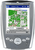
KATHLEEN BENNETT recently bought a device that keeps track of her location with help from the satellites of the Global Positioning System. But unlike many other people in Seattle, Ms. Bennett is not, by her own description, “an outdoor person” and will not be using it to find her way through the wilderness.
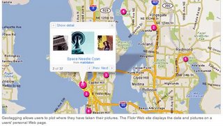
Kathleen Bennett uses a Global Positioning System unit when she takes her pictures. That data, and her pictures, are displayed on maps on her page on Flickr.
Instead, the new gadget is an accessory for Ms. Bennett’s personal passion, photography. She is one of many people who have taken up geotagging, which, broadly speaking, is the practice of posting photos online that are linked to Web-based maps, showing just where in the world the shutter was pressed. The rest of the article here.

0 Comments:
Post a Comment
<< Home