Monday, March 20, 2006

GLS Game Update and Pscyhogeography

Continuing the work on this game for GLS - I had a talk with Kurt Squire and Constance Steinkuhler last Friday. There were several things that came out of it. I've got a better idea of the involvement of NPCs and a good idea for how we are going to develop connections to places. The game will two modes - one that will take place in a short amount of time and the other over the two+ days. So, people can involve themselves on what ever scale they want to. Just some other words that came up - Geocaching, Fantasy, Forward, Social Activity


On a more academic focus, I've come across the term pscyhogeography in a few the searchs I have done on the web. Looking into content on the web, the concern are centered on action with in an environment. For me this is another idea or form of research that could add to our understanding of AR, going along with Activity Theory and Distributed Cognition.

Thursday, March 16, 2006

GeoBlogging

It's here. It's cool. Soon it will be on your GPS phone -- mark my words.

I suppose we need to wait for a better text-entry system. I can't see thumb-typing as a long term solution.

Saturday, March 11, 2006

GPS+PC+Phone+Camera

Now they need to get smaller. But the idea is here. Sprint has been offering Location-Based-Services (LBS) since 2001 -- before it was federally mandated -- and has even teamed up to use Microsoft's APIs.Besides finding carjacked toddlers, the technology could be used for something important, um ... like games (the kid is fine).

As this May 2005 article points out, place-based games aren't the only option (and to be honest, the article even failed to mention games...), but does mention other PBI activities that I've mentioned on this here before -- although their focus os on the commercial aspects rather than the educational aspects:
Bones in Motion monitors and measures physical activity in fitness programs. It records time, distance, speed, location, and calories burned while engaging in outdoor activities. Users can view activity summary, maps (street/topographical/satellite), and speed/elevation charts on their GPS-enabled phones, upload results to a personal online journal, and download maps of routes where other users have run, cycled, or walked — for example, when visiting a new city.
Bones in Motion received $60,000 in cash and $175,000 worth of NAVTEQ map licenses. Other category winners, who garnered $10,000 cash and $75,000 worth of map licenses each:

* in personal security, Clarity Communication Systems Inc. for Whereabouts, a child/teen tracking service for parents;
* in peer-to-peer/find me, LOC-AID Technologies for helping users locate friends, children, family members, or nearby points of interest, and to share their own location with designated peers;
* in navigation/POI look-up/traffic, InfoGation Corporation for Adeona, giving real-time traffic, weather and gas-price information, and nearby points of interest;
* in commerce/advertising/buying/billing, Smarter Agent, acquiring user location from the phone and delivering data such as sale prices, comps, taxes, and houses for sale and recently sold in the vicinity;
* in gaming/location-based imaging, Networks In Motion, Inc. for PhotoFinder, enabling users to manage photos containing location tags, view them on a map, and send to another phone or website with navigation to the spot where the picture was taken.
But where is learning? And who's addressing that? Well, I hope that the work MIT is doing with their new ARG editor will evolve and make the leap into cell phones. It is currently very difficult to program for mobile phones due to silly stuff like trade secrets -- the companies are not openly sharing that information, leaving the heavy lifting to individuals to discover it on their own (and post it to their blog).

Will this change? Yes. Soon? I think so. How do we prepare? Good question. I'm trusting the MIT programmers on this one to make that jump when they deem it most optimal. I'll just try to keep up on the sideline with my stuff.
Monday, March 06, 2006

GLS game update

Spent a few days last week scouting locations for the game. With the conference being specific to the Monona Terrace, I began there. I gathered info that might be interesting and which is context specific. From there, I walked outside and decided that visual interest would define how I moved. Of prominence coming out of the Terrace was the State Capitol. I proceeded. Though once you are in the Capitol I found that my visual guide no longer worked. I was standing in the middle of the rotunda and all directional choices were similar. Delineated by street names and cardinal directions, I wasn't sure exactly which way to proceed. I began to check out each exit, noting differences and where I was being lead to.

Then I began just to map places of interest - I have a long list of possible restaurants, cafes, bars, etc. We might pick up on these as possible sponsors or just point to move from.

Meet with John also and we spoke about how this information might be used. Started with a map and began to draw possible avenues for movement. We made some interesting head way if only for a short period of time.

John - if you read this, I'd like you to comment on your experience of the meeting. What did you find interesting.

Will be meeting with Kurt tomorrow and will like to hear his ideas. Will then hope to have much of the game organized by the end of next week.

Thursday, March 02, 2006

What are Augmented Reality Games (ARGs)?

5.2. Augmented Reality Games (ARGs)
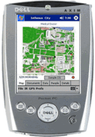
The general idea of an ARG, as our research group is using it, is built on the constraints and affordances of the MIT game available. The game engine was developed at MIT with a Games-to-Teach grant, and merges handheld computers (Pocket PC), with GPS (Global Positioning System) units. For the players, game space is real space, tracked by GPS and plotted onto the handheld computer. The space that they move through is somewhat familiar -- they know it as a place with recognizable and culturally-familiar features -- but the game reveals added or augmented content that is meaningful within the frame of the game. So, just as a tree might have the augmented meaning of a goal or safe area in a children's game, a tree may be endowed with properties and meanings in these games, triggered by the GPS unit as they approach the tree in the game.

What is Augmented Reality?

5.1. Defining Virtual and Augmented Reality

Augmented Reality is a troublesome term for me because it seems too specifically defined. Whereas virtual reality suggests an immersive and interactive, entirely artificial environment, augmented reality seems to be increasingly defined by a digitally processed alteration of our visual and aural field of the settings we inhabit. When we think of virtual reality (Figure 1) we tend to think of people standing in safe space within a room wearing wired helmets and gloves feeling like they are flying or swimming or otherwise interacting in an environment that may have no sensory parallels to the space they are actually located (except for temperature and smells -- although this may soon change).

When we consider an augmented reality situation (Figure 2), we tend to imagine them walking around, still wearing helmets, visually and audibly aware of their physical space, but also noticing objects and events that are not physically occurring in those spaces. These understandings are more specific and specialized than the augmented reality gaming that I am interested in, which is gaming in augmented spaces -- regardless of the level of technology. At this broader definition, a single sheet of paper could be all the technology needed for a good augmented reality game. Perhaps we need to consider another name, and leave the term "augmented reality" to the tech-heavy researchers, but that is an argument for a future discussion.